2002, Volume 4, Issue 12
Strategic Study of CAE >> 2002, Volume 4, Issue 12
The Current Situation and Progress of Military Geographic Information System
The Institute of Surveying and Mapping, Information Engineering University of PLA , Zhengzhou 450052, China
Next Previous
Abstract
Under the condition of information campaign, Military Geographic Information System (MGIS) is attached importance to as battlefield geographic environment platform for doing battle command automatization, digitalized battlefield and modern weapon system. U.S.A. has invested a great deal of manpower, material resources and money to successively develop and use a series of application systems such as terrain analysis system. Nowadays, U.S.A. is setting about developing TPED and geospatial information system. China began to develop MGIS later, but developed quickly. Now the MGIS software has been developed, which is the first tool software with independent copyright in China. The software adopts hierarchic architecture and objected-oriented design method. It has complete functions, compact frame, and high security. In this paper, based on the analysis of MGIS both in domestic and overseas area, the author mainly introduced the characteristics of MGIS software development, and discussed some problems to be solved in farther development.
Figures
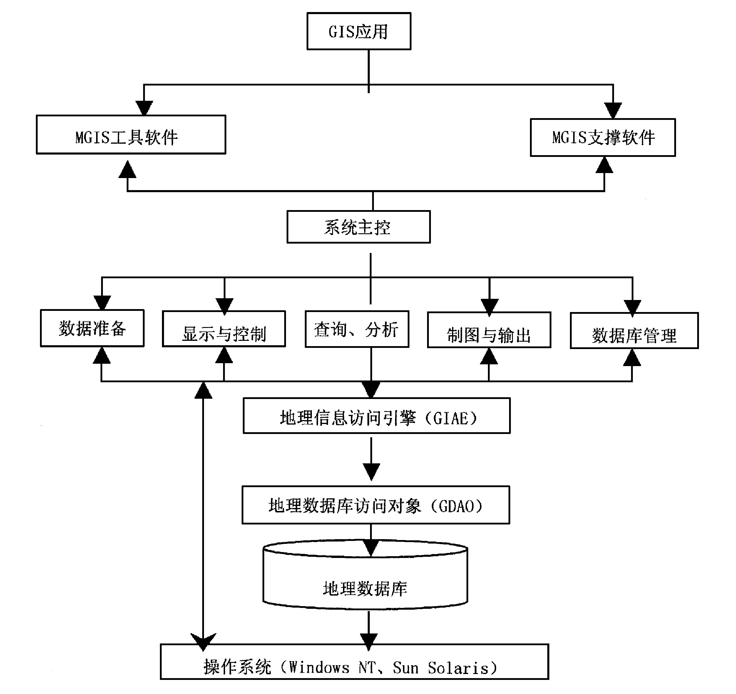
图1
References
[ 1 ] MichaelRF , MichaelR .Electronicwarefareforthedigitizedbattlefield[M ].BostonLondon:Artechhouse, 2001.11~12
[ 2 ] 李英军, 马晓星, 蔡 敏, 等译.设计模式———可复用面向对象软件的基础[M ].北京:机械工业出版社, 2000.91~146
[ 3 ] BosslerJD , ed.Manualofgeospatialscienceandtechnology[M ].LondonandNewYork:TaylorandFrancis, 2001.75~616
[ 4 ] FisherP , UnwinD , ed.Virtualrealityingeography[M ].LondonandNewYork:TaylorandFrancis, 2002.47~49


 京公网安备 11010502051620号


