
2009, Volume 11, Issue 8
Strategic Study of CAE >> 2009, Volume 11, Issue 8
Atlas design and production of Wenchuan Earthquake disaster
1. National Geomatics Center of China, Beijing 100048, China;
2. Beijing Normal Univesrity, Beijing 100875, China;
3. Map Publishing House of Chengdu, Chengdu 610100, China
Next Previous
Abstract
The atlas of Wenchuan Earthquake disaster was published in the beginning of 2009. It provides a comprehensive presentation of mechanism governing the devastating quake, the major disaster casued, the emgency response, and the reconstruction plan. Advanced spatio-temporal represention techniques were used integratedly in the design and production of the atlas, such as remotely sensed images, three dimensional digital models, and specific symbols for earthquake disaster. The atlas is considered as a fundemantal material and scientific refrence for the study of natural catastrophes, disaster recovery, and public awareness of natural disaters. This paper gives a brief introduction of the design concept of the atlas and its relevant methodology, major contents,spatial-temporal representation techniques, as well as the organizational strategy.
Keywords
atlas of Wenchuan Earthquake disater ; visualization of geo-information ; design and production
Figures

图1
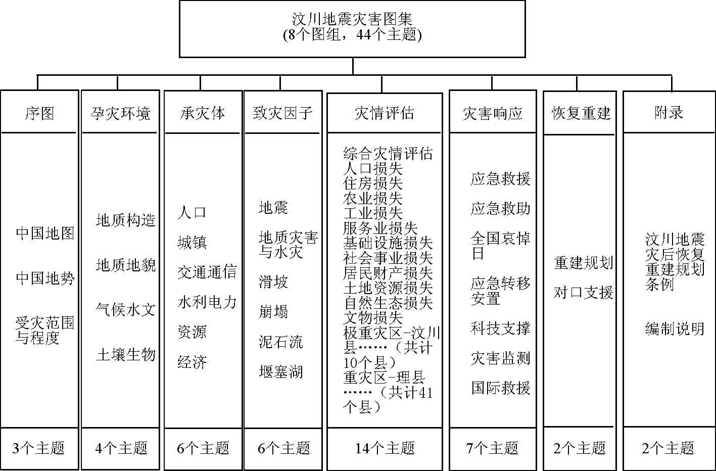
图2
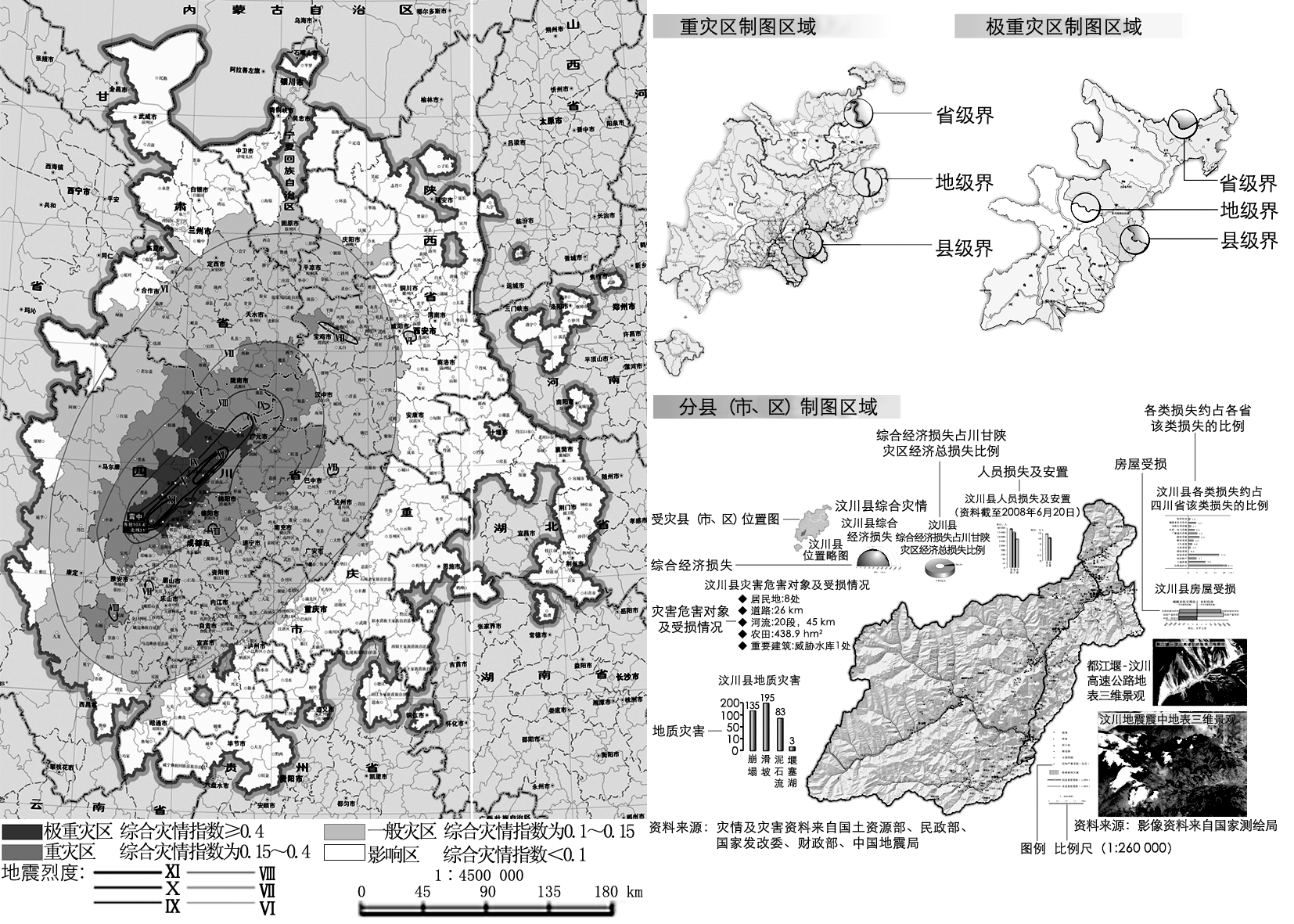
图3

图4

图5
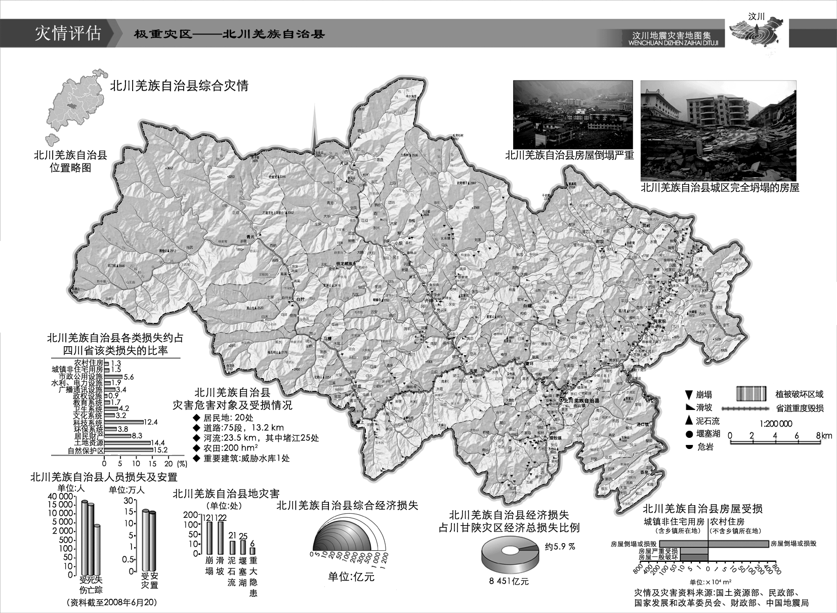
图6

图7
References
[ 1 ] 陈昱.现代地图集设计与研究[M].北京:科学出版社,2005
[ 2 ] 祝国瑞.地图设计与编绘[M].武汉:武汉大学出版社,2005
[ 3 ] 周湛.地图记录大地震—从中国历史地图集看大地震[N].中国测绘报,2008-07-29(7)
[ 4 ] 史培军.中国自然灾害系统地图集[M].北京:科学出版社,2003
[ 5 ] 图集编委会.中国历史地震图集[M].北京:中国地图出版社,1990
[ 6 ] 国家减灾会科技部抗震救灾专家组.汶川地震灾害综合分析与评估[M].北京:科学出版社,2008
[ 7 ] 国家发展改革委员会.汶川地震灾后恢复重建总体规划[N].光明日报,2008-08-13(10-12)
[ 8 ] 陈军,何超英,朱武,等.汶川抗震救灾的地理信息综合应急服务[J].地理信息世界,2008,6(6):7-11 link1


 京公网安备 11010502051620号


