2014, Volume 16, Issue 6
Strategic Study of CAE >> 2014, Volume 16, Issue 6
Geolocation method of HY-2 satellite microwave radiometer
1. Ocean University of China,Qingdao,Shandong 266100,China;
2. National Satellite Ocean Application Service,Beijing 100081,China
Next Previous
Abstract
Using cone scanning method, microwave radiometer of HY-2 satellite measures the SST and the atmosphere of the earth. This article represents one geolocation method applied to the microwave radiometer of HY-2 satellite according to the geometry model. The image of microwave radiometer was geolocationed with this method, and the result was evaluated at last.
Keywords
Figures

图1

图2
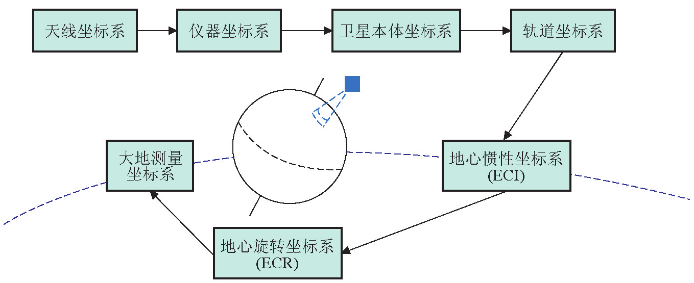
图3
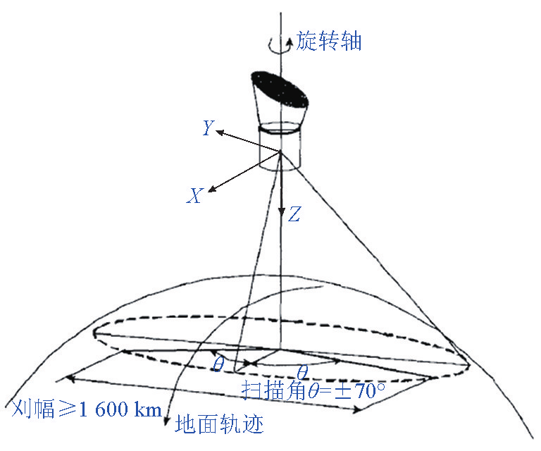
图4
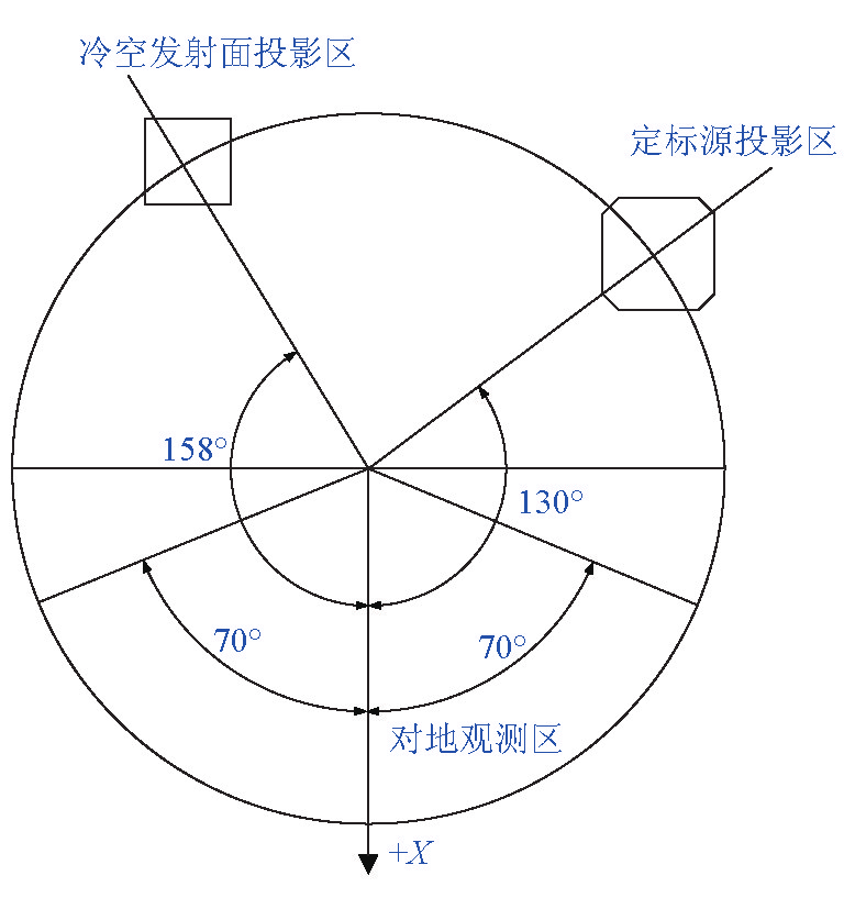
图5

图6

图7

图8
References
[ 1 ] 关 敏,杨忠东. FY-3 微波成像仪遥感图像地理定位方 法研究[J]. 遥感学报,2009,13(3):469-474. link1
[ 2 ] 海洋二号卫星介绍[EB/OL]. http://www.nsoas.gov.cn/HY2A Zhuanti/HY2A/hy202.html.
[ 3 ] 李济生. 人造卫星精密轨道确定[M]. 北京:科技出版社,2008.
[ 4 ] 刘 林. 人造地球卫星轨道力学[M]. 北京:高等教育出版社, 1992.
[ 5 ] 章仁为. 卫星轨道姿态动力学与控制[M]. 北京:北京航空航天 大学出版社,1998.


 京公网安备 11010502051620号


