
2014, Volume 16, Issue 6
Strategic Study of CAE >> 2014, Volume 16, Issue 6
Precise orbit determination technology based on dual-frequency GPS solution for HY-2A satellite
1. National Satellite Ocean Application Service,Beijing 100081,China;
2. University of Wuhan, Wuhan 430072,China
Next Previous
Abstract
The GPS data acquired by the HY-2A satellite GPS receiver have been used in a dynamic orbit determination, which was based on the description of the gravitational and nongravitational forces in the equations of motion. The GPS carrier data were processed in a difference mode to remove clock errors. Simultaneous estimation of the HY-2 satellite orbit and GPS orbit was performed using the data in March (2012). The resulting HY-2 satellite orbits have been compared with CNES orbits and reduced dynamic orbits for GPS/DORIS/SLR strategies, and in the meantime confirmed with SLR validation. The radical component of the GPS orbit was found to agree with better than 3 cm.
Keywords
Figures
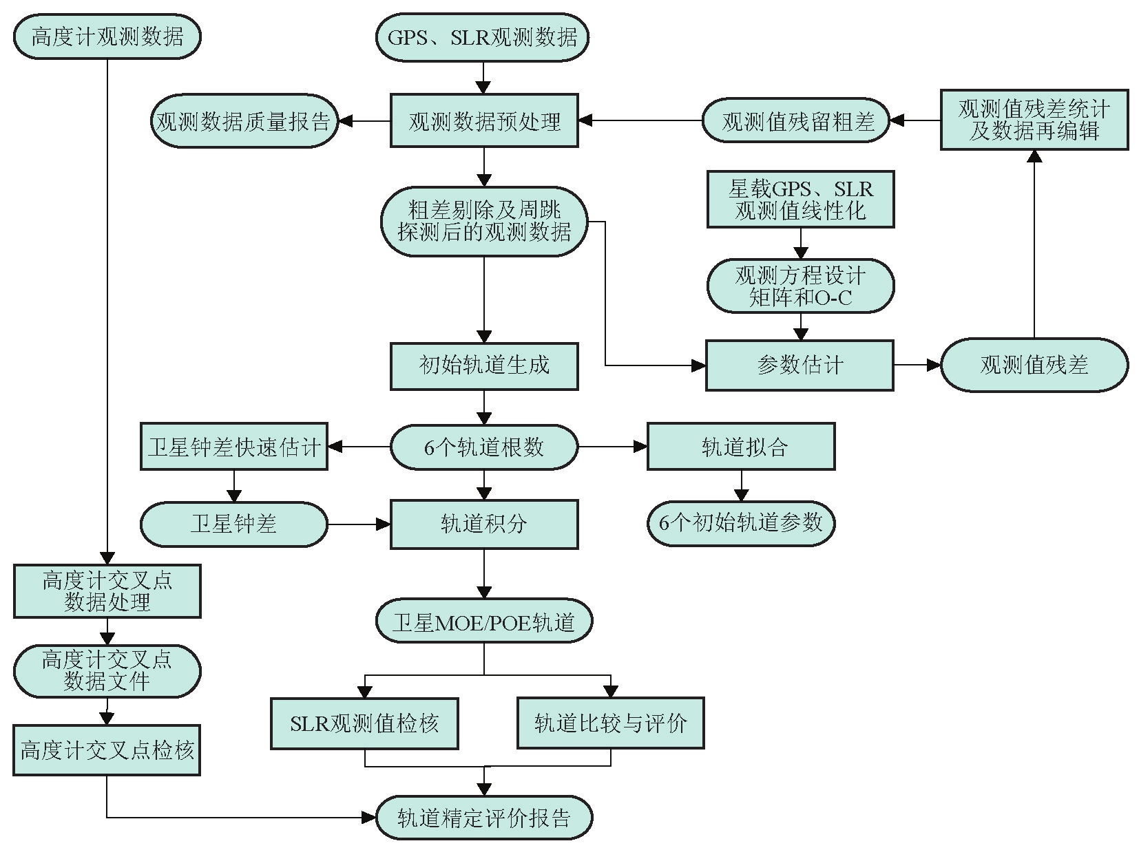
图1
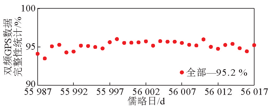
图2
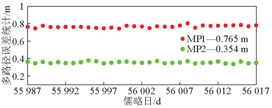
图3

图4
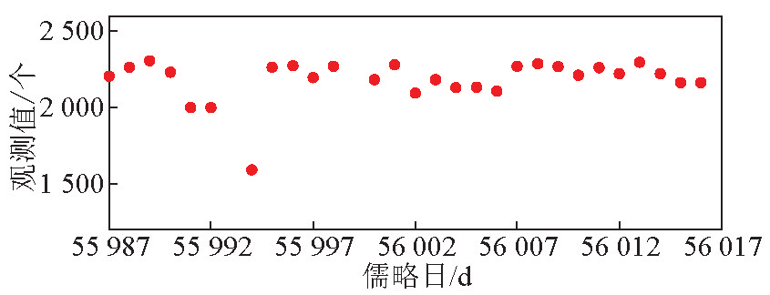
图5
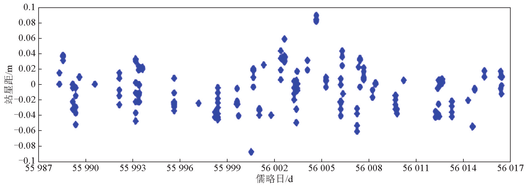
图6
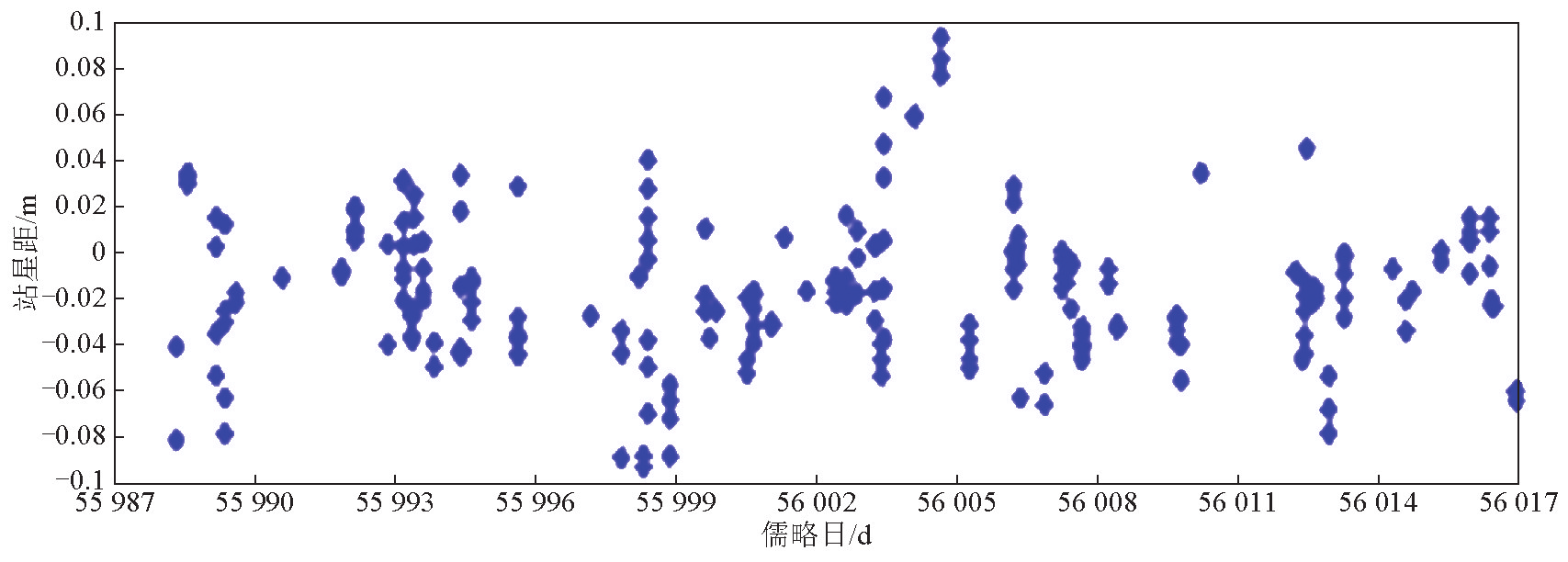
图7
References
[ 1 ] Cerril L,Berthias J P,Bertiger W I,et al. Precision orbit determination standards for the Jason series of altimeter missions[J]. Marine Geodesy,2010,33(S1):379-418. link1
[ 2 ] Wily Bertiger,Shailen D Desai,Angie Dorsey,et al. Sub-Centimeter precision orbit determination with GPS for ocean altimetry [J]. Marine Geodesy,2010,33(S1):363-378. link1
[ 3 ] Cerri L,Berthias J P,Bertiger W I,et al. Precision orbit determination standards for the Jason Series of altimeter missions [J]. Marine Geodesy,2010,33(S1):379-418. link1
[ 4 ] Ablain M,Philipps S,Picot N,et al. Jason-2 global statistical assessment and cross-calibration with Jason-1[J]. Marine Geodesy, 2010,33(S1):162-185. link1


 京公网安备 11010502051620号


