2022年 第19卷 第12期
《工程(英文)》 >> 2022年 第19卷 第12期 doi: 10.1016/j.eng.2022.10.002
“天空之眼”向全世界开放
Senior Technology Writer
下一篇 上一篇
图片
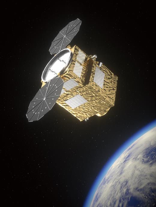
图1

图2
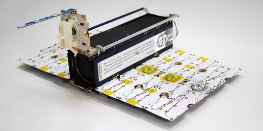
图3
参考文献
[ 1 ] Airbus’ final two dispenser-free Pléiades Neo constellation satellites ready for launch [Internet]. Sonoma: Satnews; 2022 May 19 [cited 2022 Aug 30]. Available from: https://news.satnews.com/2022/05/19/airbus-final-twodispenser-free-pleiades-neo-constellation-satellites-ready-for-launch/. 链接1
[ 2 ] Commercial satellite imaging market to surpass US $ 12.4 billion by 2032 [Internet]. Newark: Future Market Insights; 2022 May 4 [cited 2022 Aug 30]. Available from: https://www.globenewswire.com/en/news-release/2022/05/04/2435903/0/en/Commercial-Satellite-Imaging-Market-to-Surpass-US-12-4-Billion-by-2032-Future-Market-Insights.html. 链接1
[ 3 ] Palmer C. Russian anti-satellite test spotlights space debris danger. Engineering 2022;12:3‒5. 链接1
[ 4 ] Jagula D. Satellite imagery for everyone [Internet]. New York City: IEEE Spectrum; 2022 Feb 19 [cited 2022 Aug 30]. Available from: https://spectrum.ieee.org/commercial-satellite-imagery. 链接1
[ 5 ] Schneider D. US eases restrictions on private remote-sensing satellites [Internet]. New York City: IEEE Spectrum; 2020 Jul 1 [cited 2022 Aug 30]. Available from: https://spectrum.ieee.org/eased-restrictions-on-commercialremote-sensing-satellites. 链接1
[ 6 ] Shelly J. Satellites are going mainstream; here’s how insurance can reap the benefits [Internet]. Blue Bell: Risk & Insurance 2019. Feb 10 [cited 2022 Aug 30]. Available from: https://riskandinsurance.com/satellites-and-insurance/. 链接1
[ 7 ] Partnoy F. Stock picks from space [Internet]. Washington, DC: The Atlantic; 2019 May 1 [cited 2022 Aug 30]. Available from: https://www.theatlantic.com/magazine/archive/2019/05/stock-value-satellite-images-investing/586009/. 链接1
[ 8 ] Tucker A. Space archaeologist Sarah Parcak uses satellites to uncover ancient Egyptian ruins [Internet]. Washington, DC: Smithsonian Magazine; 2016 Dec 1 [cited 2022 Aug 30]. Available from: https://www.smithsonianmag.com/innovation/space-archaeologist-sarah-parcak-winner-smithsonians-historyingenuity-award-180961120/. 链接1
[ 9 ] Lang F. Scientists use satellite imagery to count elephants [Internet]. New York City: Interesting Engineering; 2021 Jan 20 [cited 2022 Aug 30]. Available from: https://interestingengineering.com/science/scientists-use-satellite-imageryto-count-elephants. 链接1
[10] O’Neill S. Climate change action alights on satellite detection of methane. Engineering 2022;16:9‒12. 链接1
[11] Jean N, Burke M, Xie M, Davis WM, Lobell DB, Ermon S. Combining satellite imagery and machine learning to predict poverty. Science 2016;353(6301): 790‒4. 链接1
[12] Wall M. Satellites uncover widespread illegal fishing in Pacific Ocean [Internet]. New York City: Space; 2020 Jul 22 [cited 2022 Aug 30]. Available from: https://www.space.com/illegal-fishing-squid-satellite-imagery.html. 链接1
[13] Yazici T. A proposal for the usage of reconnaissance satellites to monitor international human and wildlife trafficking hotspots. Acta Astronaut 2022;195:77‒85. 链接1
[14] Derouin S. Leveraging satellite sensors for oil spill detection [Internet]. Washington, DC: Eos; 2020 Mar 26 [cited 2022 Aug 30]. Available from: https://eos.org/articles/leveraging-satellite-sensors-for-oil-spill-detection. 链接1
[15] O’Neill S. Satellite tracking and global treaty effort open new front on plastic waste problem. Engineering 2022;17:3‒6. 链接1
[16] Perry TS. Satellites and AI monitor Chinese economy’s reaction to coronavirus [Internet]. New York City: IEEE Spectrum; 2020 Mar 10 [cited 2022 Aug 30]. Available from: https://spectrum.ieee.org/satellites-and-ai-monitor-chineseeconomys- reaction-to-coronavirus. 链接1
[17] Cunningham E, Bennett D. Coronavirus burial pits so vast they’re visible from space [Internet]. Washington, DC: Washington Post; 2020 Mar 12 [cited 2022 Aug 30]. Available from: https://www.washingtonpost.com/graphics/2020/world/iran-coronavirus-outbreak-graves/. 链接1
[18] Kraetzig NM. A definitive guide to buying and using satellite imagery [Internet]. Berlin: Up42; 2021 Jan 15 [cited 2022 Aug 30]. Available from: https://up42.com/blog/tech/a-definitive-guide-to-buying-and-using-satelliteimagery. 链接1
[19] Buczkowski A. Pléiades Neo is raising the bar for the remote sensing and imaging industry [Internet]. Warsaw: Geo Awesome; 2022 Feb 6 [cited 2022 Aug 30]. Available from: https://geoawesomeness.com/eo-hub/pleiades-neois-raising-the-bar-for-the-remote-sensing-and-imaging-industry/. 链接1
[20] Calzolaio D, Curreli F, Duncan J, Moorhouse A, Perez G, Voegt S. EDRS-C—the second node of the European Data Relay System is in orbit. Acta Astronaut 2020;177:537‒44. 链接1
[21] Werner D. Planet to acquire VanderSat in $28 million deal [Internet]. Alexandria: Space News; 2021 Nov 10 [cited 2022 Aug 30]. Available from: https://spacenews.com/planet-to-acquire-vandersat/. 链接1
[22] SkySat instruments: explore instruments used in SkySat mission [Internet]. Brussels: European Space Agency; [cited 2022 Aug 30]. Available from: https://earth.esa.int/eogateway/missions/skysat. 链接1
[23] Capella Space’s next generation satellites with enhanced imagery capabilities [Internet]. Sonoma: Satnews; 2022 Aug 10 [cited 2022 Aug 30]. Available from: https://news.satnews.com/2022/08/10/capella-spaces-next-generationsatellites-with-enhanced-imagery-capabilities/. 链接1
[24] Sheetz M. Microsoft wants to take on Amazon in connecting satellites to the cloud [Internet]. Englewood Cliffs: CNBC; 2020 Sep 11 [cited 2022 Aug 30]. Available from: https://www.cnbc.com/2020/09/11/microsoft-azure-versusamazon- aws-in-connecting-satellites-to-cloud.html. 链接1
[25] Rolf E, Proctor J, Carleton T, Bollinger I, Shankar V, Ishihara M, et al. A generalizable and accessible approach to machine learning with global satellite imagery. Nat Commun 2021;12:4392. 链接1
[26] Singh I. The perfect storm called artificial intelligence and geospatial big data [Internet]. Warsaw: Geo Awesome; 2017 Nov 14 [cited 2022 Aug 30]. Available from: https://geoawesomeness.com/the-perfect-storm-calledartificial-intelligence-and-geospatial-big-data/. 链接1
[27] Kumar M. Meet IMGeospatial: the startup that uses AI and remote sensing to extract actionable intelligence for businesses [Internet]. Warsaw: Geo Awesome; 2019 Jun 20 [cited 2022 Aug 30]. Available from: https://geoawesomeness.com/imgeospatial-startup-ai-remote-sensingbusiness-intelligence/. 链接1


 京公网安备 11010502051620号


