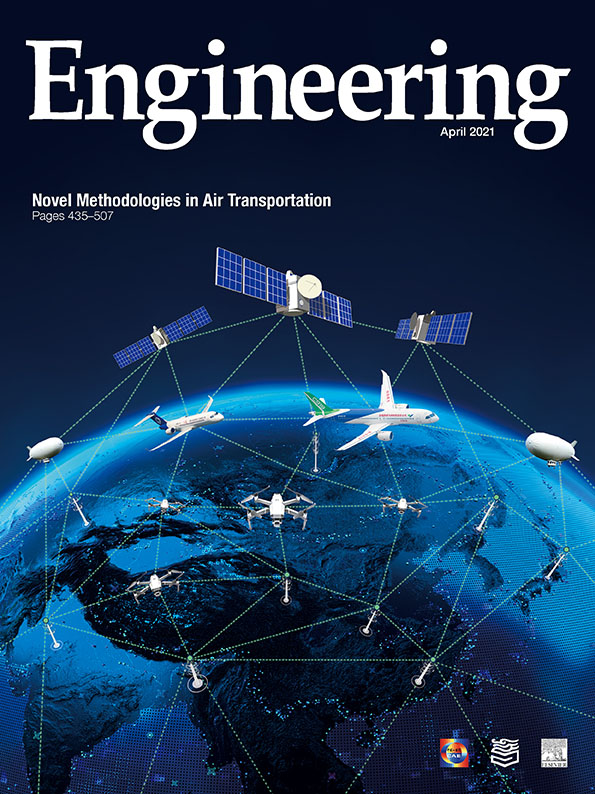
With the launch of a satellite in June 2020 (Fig. 1), China completed BeiDou (‘‘Big Dipper”), its global navigation satellite system (GNSS), a work-in-progress for the last 20 years [1]. BeiDou’s fully operational debut coincides with the rapid buildup in the past decade of the European Union’s GNSS, Galileo, with 22 operational satellites at the close of 2020 (Fig. 2), as well as upgrades to Russia’s GNSS, GLONASS, which attained full operation over the last eight years after shrinking to only seven satellites in 2002 [2]. Now, after more than two decades of, for the most part, only the 24–31 satellites of the US Global Positioning System (GPS) serving as global reference points of position and time for terrestrial GNSS users planet-wide, these newer systems and upgrades have dramatically increased the density of coverage by navigation satellites of nearly every square meter of Earth.
《Fig. 1》

Fig. 1. An enormous expansion in the past quarter century has led to a roughly fourfold increase in the world’s fleet of navigation satellites, coupled with improvements in their capabilities and services. Most of the leap in satellite numbers and performance owes to investments of tens of billions US dollars and ambitious programs of design, construction, and launch of spacecraft plus wideranging buildups of aerospace infrastructure by China and the European Union since the start of the 21st century. China’s 55th satellite navigation-related rocket launch on 23 June 2020 from Xichang Satellite Launch Center in the country’s mainland lofted a satellite into geostationary orbit, nearly 36 000 km above Earth. This capstone on BeiDou raised the system’s count of working satellites to 45, of which 30 constitute the fully operational satellite navigation constellation. Credit: China Satellite Navigation Office (public domain).
《Fig. 2》
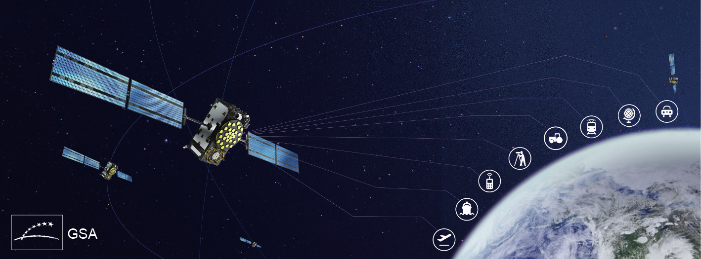
Fig. 2. An artist’s illustration highlights one of the solar-powered spacecraft in the European Union’s Galileo constellation of navigation satellites as it circles the planet in a medium-Earth orbit at an altitude of just over 23 200 km. The satellite’s main antenna (disk studded with gold blocks at the front-center of the craft) continuously broadcasts timing and position radio signals to Earth, providing data used globally by billions of people, smartphones and other devices, and networks across a range of industries, services, and other fields, including aviation, surveying, agriculture, transportation, and others. Nearing completion, Galileo awaits additional launches in 2021–2022 to reach its full operational complement of 30 satellites, including six spares. GSA: European GNSS Agency. Credit: ©GSA, with permission.
The new multi-constellation of four GNSS [3] providing location and time signals to billions of people, machines, and computer networks across the planet, has grown the number of navigation satellites by more than 300% to about 125, with more on the way. As a result, a user previously able to receive broadcasts under open skies from about eight GPS satellites can now typically access transmissions from a mixture of about 30 satellites, and upwards of 50 in some places, said Bradford Parkinson, who as a US Air Force Colonel during critical, initial stages in the 1970s served as chief architect and director of GPS development and testing, and played a key role in convincing the US military to fund the system’s full-scale deployment [4,5].
Generally, the more satellite signals a GNSS receiver can simultaneously access, the better the accuracy of the position measurement. However, the improvement derived from each additional acquired signal starts to diminish as the number of transmissions collected goes above about eight to ten. In aggregate, however, a systemic boost in the number of available satellites tilts the scales toward more exact position measurements. With more satellites to choose from, receivers can select the subset of spacecraft performing optimally and best distributed geometrically to yield higher accuracy readings. The GNSS multi-constellation ‘‘brings more satellites and more signals, and, yes, they will improve accuracy,” said Yang Gao, professor of geomatics engineering at the University of Calgary in Canada. ‘‘But that is not the most important change. With more measurements available at the user end, solutions are more reliable.”
Although a big semitrailer truck might briefly degrade the integrity of space-based positioning inside a passing car even when many satellites are available, an increased number of satellites can boost overall GNSS performance. More satellites means better odds that the passing truck leaves enough signals unimpeded for an accurate position fix at a crucial moment. Importantly, should reception or accuracy problems stem from something more insidious, like jamming or spoofing of GNSS broadcasts [6], the plethora of satellites to choose from—especially if they are in different GNSS—sharply reduces the chances of a stymied position measurement or unwitting acceptance of a false one, said Parkinson, who also made numerous, pioneering contributions to satellite navigation as a professor (now recalled emeritus) of aerospace engineering at Stanford University in Stanford, CA, USA.
‘‘You can think of the other constellations as potential ‘black swan’ killers,” Parkinson said, referring to a widely used metaphor for highly unlikely failures that can befall systems even when they have been designed and built with due diligence to fail-safe operation [7]. For instance, among a variety of ways the multi-constellation’s diversity of satellites and high availability can protect the integrity of the system’s position and timing solutions is a technique called Receiver Autonomous Integrity Monitoring [8]. In this scheme, if more than six satellites are available, a user’s all-GNSS receiver can defeat spoofing and protect against satellite or GNSS malfunctions by, in real time, cross-comparing position solutions calculated from the available signals and then rejecting the ones whose flawed data make them outliers.
Beyond sheer spacecraft numbers, shared standards for functionality and performance adhered to in building and operating the four GNSS systems bolster interoperability [9]. In addition, numerous recent technical advances, such as space-qualified, extraordinarily stable, passive hydrogen maser atomic clocks used as the master clocks in both Galileo and BeiDou satellites, aid timing consistency and accuracy [10,11]. Those performance refinements both steady the foundations of interoperability and help enable new or expanded capabilities of individual and multiple GNSS, said aerospace engineer Guerric Pont, European GNSS Agency (GSA) acting head of the Galileo Services Department. For example, both BeiDou and Galileo offer improved satellite-assisted search and rescue services worldwide by upgrading the speed with which their systems can pinpoint where distress signals from ship collisions or other life-threatening mishaps originate. In late November 2020, during the Vendée Globe competition for solo sailing, a powerful wave in the Indian Ocean broke in half a French racing yacht equipped with a beacon for broadcasting a distress signal. The alert reached three Galileo spacecraft, nearly all of which are equipped with electronics and antennas for detecting and processing such alarms, Pont said. ‘‘Between the emission and detection of the signal and the first localization, it took about two minutes only. And, after three minutes, the notification to the rescue center was sent,” he said. Both systems can also send brief return signals to acknowledge receipt of the call for help and alert the senders that rescuers have been notified and are on the way [12,13].
Other advances designed into BeiDou and Galileo also raise the bar of position and timing performance for those systems. Galileo’s still expanding network of ground stations uploads new calibrations to its satellites of their precise positions in space every 80 min, said Pont. The accuracy of spacecraft timing and positions is part of the bedrock of supplying users with dependable coordinates for their own three-dimensional locations and any auxiliary GNSS services that rely on those exact positions and times. In general, between calibrations, sophisticated orbital prediction models provide GNSS satellites with exquisitely fine-tuned estimates of their exact positions in space [5,14].
Implementing another strategy for minutely tracking satellite locations, BeiDou engineers developed a system of intersatellite ranging and communications signaling made possible by electronically steerable antennas on constellation spacecraft. Studies Studies have shown that these "intersatellite links" enable the constellation to attain significantly more accurate measurements of its satellites’ locations in space as well as more precise predictions of their orbits than can be derived from observations provided by ground stations alone [15]. The links also enable a range of distinctive communications services. For example, they can be used to transmit messages between specific senders and recipients via subsets of the constellation’s spacecraft, on both regional and global scales [13].
The multi-constellation also harnesses new radiofrequencies and uses a greater abundance and diversity of frequencies to expand the services and optimize the capabilities that satellite navigation technology can offer. GPS, the lone GNSS for decades, initially broadcast its position and timing data publicly on just one frequency, 1575.42MHz, known simply as L1, for civilian use and on a supplementary second frequency of 1227.60 MHz, called L2, accessible only to the US military [14]. However, Galileo’s initial design, said Pont, called for 11 signal components. A white paper on BeiDou indicates that it uses at least five separate civilian frequencies [16]. GPS and GLONASS have been following suit, with the newest GPS satellites now broadcasting ten signals, said Parkinson, using multiple frequencies in addition to the original ones [17].
Being able to receive position data on two different frequencies confers improved accuracy noticeable to users of smartphones equipped with dual-frequency GNSS receivers. The capability reduces position errors from delays of signals traversing the ionosphere and from signals reflecting off surfaces like the walls of urban canyons lined with skyscrapers [18]. By design, transmitting the ranging signals that reveal position over dual frequencies is nearly universal among Galileo satellites, said Fiametta Diani, an aerospace engineer who heads the GSA’s development of applications and markets for space data. This means that manufacturers that include the constellation and dual-frequency capability in their GNSS receiver chips for smartphones ‘‘are adding something more than just a multi-GNSS solution with greater satellite availability,” Diani said. ‘‘It brings better accuracy that in an urban environment, for example, would permit you to distinguish which side of the road you should wait on for your taxi or Uber, something you were not able to do before.”
In addition to making it easier for people to find their rides, the expanded frequencies are enabling enhanced or new services, such as Galileo’s search and rescue with its return link, an upcoming navigation data authentication function to thwart spoofing, and a high accuracy service for fast, extremely precise positioning. BeiDou similarly plans a service that broadcasts corrections for accelerated high accuracy positioning.
The growing number of GNSS operational frequencies also has implications for future technologies tied to fifth-generation (5G) mobile wireless networks, said Gao, such as autonomous cars, ‘‘smart cities,” and the densely populated, interactive Internet of Things [19,20]. The multi-constellation is key to providing both the accurate, stable, ubiquitous time signals and the absolute positioning solutions at the heart of these technologies, likely delivered by fast position-convergence algorithms utilizing three or more different GNSS frequencies simultaneously, Gao said. Additional signals from auxiliary, relative-position sensors aboard vehicles and other devices will also be involved and, potentially, data from low Earth orbit satellites. When he and his colleagues consider the range of practical tasks and problems to which this potent mix of satellite, sensor, and networking capabilities could be applied, Gao said, ‘‘we are only limited by our imaginations.”


 京公网安备 11010502051620号


