《1 Introduction》
1 Introduction
The ocean is rich in biological, mineral, pharmaceutical, space, seawater, and energy resources. It is a strategic place for humanity to solve the resource shortages and expand the space for survival and development. Deep understanding of the mysteries of marine science, efficient development and utilization of marine resources, effective protection of the marine environment, and strong protection of marine rights and interests are inseparable from the development of marine science and the support of marine science equipment.
Marine science equipment is a tool used to observe the natural phenomena and laws in the ocean under natural conditions. It plays an important or even decisive role in marine scientific research and is mainly divided into: (1) ocean observation/detection sensors, such as interferometers, ocean lidar, synthetic aperture radar, ocean flux sensors, conductivity–temperature–depth sensors, acoustic Doppler velocity profilers, marine biological sounders, multi-type acoustic sensors, and multi-type geomagnetic detection sensors; (2) ocean observation/detection platforms, such as ocean remote sensing satellites, surface research vessels, multiple types of surface buoys, multiple types of underwater submersibles, multiple types of deep submersibles, multi-parameter underwater gliders, and self-sinking floating profiling buoys; (3) marine communication transmission equipment, such as airborne wireless communication equipment, surface microwave communication equipment, underwater acoustic communication equipment, water–air communication equipment (such as interface communication relay equipment), and marine data intelligent processing and analysis equipment. [1].
China and other countries attach great importance to the research and development of marine scientific equipment and have issued a series of science and technology development plans for the medium- and long-term to support the research and development of high-end marine research vessels, marine observation equipment, and marine exploration platforms. The field of marine research is expanding towards the deep sea and the North and South Poles with the aim to know, use, and protect the sea. This has put forward new requirements for intelligent, automated, and high-end marine scientific equipment, and the next 15 years will be a key period for the development of high-end marine scientific equipment. This study has conducted a systematic review of the development of marine scientific equipment, summarized the shortcomings and deficiencies of the relevant equipment in China, and considered the future development direction of China’s marine science and development strategies. It provides a theoretical basis for the rapid and steady development of China’s marine scientific equipment.
《2 Demand for marine science equipment》
2 Demand for marine science equipment
《2.1 The need for scientific knowledge of the ocean》
2.1 The need for scientific knowledge of the ocean
The ocean is vital for the survival and development of humanity. On one hand, as a global climate regulator, the ocean provides 70% of oxygen and 87.5% of water vapor to the atmosphere, while the ocean stores a large amount of heat; on the other hand, as an important part of the global physical system, qualitative changes in energy, biological, and geological processes in the ocean will have a significant impact on marine and terrestrial life. The area of the ocean accounts for approximately 71% of the total surface area of the Earth; compared to the total area of the ocean, the dark ocean with water depth greater than 200 m accounts for 95%, and the deep ocean with water depth greater than 3000 m accounts for 89% of that area. Human beings have a very low level of exploration and understanding of the ocean. They have concentrated on the shallow and offshore areas, whereas the deep ocean and the North and South Poles are scientific blind spots that are poorly understood by humans; due to the lack of knowledge of the deep ocean, polar regions, and other important areas, humans are unable to decipher some special phenomena and laws in the ocean [2].
The scientific cognition of physical, chemical, biological, and geological processes in the deep sea and the North and South Poles needs to be supported by marine science equipment. At present, maritime powers have developed manned submersibles that can work in deep-sea waters and unmanned submersibles applicable to the full ocean depth, and they have arranged submarine observation networks and mobile observation systems in some sea areas. However, the existing observation equipment barely has intelligent attributes, and the spatial layout is dominated by points and lines, covering a small area, and deep-sea observations below 2000 m are still lacking. Therefore, to better cognize the ocean, it is necessary to further develop high-end marine science equipment and develop the observation capability of the full sea depth, in an integrated and real-time manner and with high spatial and temporal resolution.
《2.2 The need to develop and utilize the ocean》
2.2 The need to develop and utilize the ocean
Resources and energy are the basis for human survival and development. With the rapid development of the economy and society, the dependence of China on external oil and gas resources has been rising, and the situation of energy security is becoming more serious. The vast ocean, especially the deep sea, which is a potential treasure trove of resources, has not yet been fully recognized and utilized by humanity, but it contains most of the Earth’s manganese, cobalt, copper, nickel, and other metal minerals and is rich in oil and gas, combustible ice, and other resources. The development and utilization of deep-sea resources and energy have strategic value for the security of China’s resource supply and national economic development.
Most marine resources and energy resources are located in the deep seafloor, which is extremely difficult to develop and utilize. China’s understanding of the mechanism of deep seabed mineralization and accumulation is not sufficient to realize a seafloor geological survey and long-term detection of seafloor geophysical fields; the combustible ice in the South China Sea is about to enter the stage of large-scale mining, which has put forward new requirements for seafloor geological stability monitoring and seafloor environmental protection; for the mining blocks of polymetallic sulfide ore areas in the Pacific Ocean and West Indian Ocean, there is an urgent need for refined mineral enrichment areas to meet the requirements for exclusive block exploration rights stipulated by the United Nations Convention on the Law of the Sea [1].
《2.3 The need to actively protect the ocean》
2.3 The need to actively protect the ocean
Currently, China’s marine environmental protection is facing serious challenges. Influenced by industrial wastewater discharge and offshore aquaculture, the water quality of offshore waters is seriously polluted, which leads to frequent outbreaks of red tides and marsh moss and degradation of coastal ecosystems [2]. Pollutants in offshore waters are gradually transferred to the deep sea with the movement of ocean currents, and millions of tons of marine garbage flow into the deep sea every year, most of which are carried by ocean currents to submarine canyons, causing damage to the deep-sea ecosystem. During the development of deep-sea resources and energy, marine engineering accidents have occurred repeatedly, and crude oil leakage and release of harmful substances have damaged the ecological environment of the nearby sea [3].
The lack of continuous three-dimensional integrated observation capability of offshore and deep-sea waters makes it difficult to judge the origin and evolutionary process of marine environmental problems and to understand the response of the coastal zone and the overall ocean system to natural disasters, which restricts the fundamental solution of marine environmental problems. It is necessary to further develop marine scientific equipment, establish a perfect three-dimensional ocean observation system, realize accurate, real-time, and dynamic observation of key sea areas, and provide basic data support for research on ocean physics, ocean chemistry, marine biology, and marine geological processes [4].
《2.4 The need for effective control of the ocean》
2.4 The need for effective control of the ocean
The sea is a matter of national interest and long-term development, and sea-related countries attach great importance to maritime rights and interests. In the Bohai Sea, China’s Yellow Sea, East China Sea, and South China Sea waters, neighboring countries have territorial sea disputes [5]. The lack of surface and underwater monitoring equipment in China’s territorial waters and the prominent underwater security problems are not conducive to the effective protection of marine homeland security and maritime space rights and interests.
In recent years, the world’s maritime powers have expanded their space in new maritime territories such as the deep seas, high seas and oceans, and North and South Poles and have launched a new round of “blue enclosure” activities. Improving the cognition and equipment level of far-reaching oceans and polar regions has become an important support for safeguarding national maritime rights and interests, maintaining the right to speak in international ocean resources, and gaining competitive advantages in ocean development. For a proper understanding, development, and utilization of the ocean, the use of automated and intelligent marine scientific equipment is required. It is necessary to build China’s air, space, and sea-based three-dimensional observation and early warning system, support the construction of the Belt and Road initiative, and expand the deep sea, North and South Poles, and other new marine frontiers.
《3 Development status of international marine scientific equipment》
3 Development status of international marine scientific equipment
《3.1 Sea–air interface observation equipment》
3.1 Sea–air interface observation equipment
The intersection of seawater and atmosphere is the sea–air interface, where energy exchange and material transport between the ocean and atmosphere occur. The observation of the sea–air interface provides support for basic research, such as sea–air multi-scale interactions and cross-ring gas–fluid–solid coupling mechanisms.
3.1.1 Ocean remote sensing satellites
The United States launched the world’s first dedicated ocean satellite in 1978, carrying active and passive microwave sensors, radar altimeters, microwave wind scatterometers, synthetic aperture radar, and other detection equipment. Its wave height measurement accuracy was of approximately 2–20 cm [6]; subsequently, the ocean water color dedicated monitoring satellite, sea surface wind speed measurement satellite, and sea surface wind field measurement satellite were launched, thereby building the third generation of the White Cloud electronic reconnaissance ocean surveillance satellites [7]. Europe focuses on the development of an integrated observation satellite system that comprises a number of ocean remote sensing satellites; the ColdSat-2 observation satellite, launched in 2010, carries a synthetic aperture interferometric radar altimeter to measure the rate of change in surface height of the polar ice cap, the thickness and area of ocean ice floes, etc. [6]. The Soviet Union launched 32 operational ocean monitoring satellites from 1967 to 1989, and built the Cosmos satellite system, involving mainly electronic ocean monitoring satellites and nuclear-powered radar ocean monitoring satellites. In 2012, Japan launched the GCOM-W1 satellite, which is equipped with a microwave radiometer and has high spatial resolution, which can measure global precipitation, water vapor, ocean wind speed, temperature, and other parameters, and several special satellites for ocean monitoring have been launched to build a global ocean 24-hour monitoring system [6].
3.1.2 Marine research ships
The United States has the most numerous and most advanced marine research fleet in the world, including 16 global-class, 23 ocean-class, six regional-class, and six local-class research vessels; for example, the polar research vessel Scuriok is equipped with a bow thruster, a maximum hydrostatic speed of 26.3 km/h, an ice-breaking rating of PC5, and a self-sustaining capacity of 45 d [8]. Europe has a large number of scientific research vessels with advanced equipment, the UK has three oceanic class research vessels, France has four oceanic class research vessels, and Germany has a new global class integrated research vessel. The British RSS Sir David Attenborough polar scientific research ship, with an icebreaker rating of PC4, a maximum speed of 31.9 km/h in still water, and a self-sustaining force of 60 d is equipped with professional scientific research instruments and equipment for scientific research of the atmosphere, ocean, and seafloor circles. In addition, the Japanese oceanographic research vessel Kaimei has an endurance of 1.67×10⁴ and a speed of approximately 22.2 km/h; it is equipped with a dynamic positioning system, a 3000 m 4-cable 3D seismic measurement system, a 12 000 m conductivity– temperature–depth profiler, a seafloor resource sampling device of a 3000 m class remotely operated vehicles (ROVs) and other instruments, and it can determine the distribution of seafloor resources and conduct environmental surveys, atmospheric and marine environmental change surveys, and other scientific studies.
《3.2 Underwater mobile observation equipment》
3.2 Underwater mobile observation equipment
Underwater mobile observation equipment is generally divided into human occupied vehicles (HOVs), ROVs, autonomous underwater vehicles (AUVs), and underwater gliders, which can be equipped with different types of sensors and acquisition equipment and can be used for the detailed detection of large areas [9].
3.2.1 HOVs
The US Alvin deep submersible is the earliest HOV in the world, originally designed to dive to a depth of 1829 m, covering approximately 63% of the world’s seafloor, with a single dive duration of 6–8 h. It is mainly used for marine biology collection, marine geological surveys, marine relics expedition, and other tasks. In 2012, the Woods Hole Oceanographic Institution in the United States upgraded Alvin, expanding its design dive depth to 6500 m. The total number of completed dives exceeds 5000 [10]. The French Nautilus deep submersible was built in 1985, designed for a maximum dive depth of 6000 m, and has made more than 1700 dives, mainly for exploration of polymetallic nodules, investigation of deep-sea bottom ecosystems, and search of shipwrecks and hazardous waste. Japan’s Deep Sea 6500 HOV was built in 1989, with a designed maximum dive depth of 6500 m, a single dive duration of 8 h, and more than 1000 cumulative dives, completing the investigation of ocean slopes and faults and the observation and research of earthquakes and tsunamis in Japanese waters.
3.2.2 ROVs
The US Jason ROV is powered by a supporting mother ship and control operations. The ROV uses high-pressure buoyancy materials and is in a free suspension state during the launching operation, with a maximum diving depth of 6500 m. It is equipped with sonar, imaging, lighting, and digital sampling systems and has high-precision underwater detection and sampling capabilities [11]; it has accumulated more than 1000 dive operations; the average dive operation duration is 21 h, and the maximum dive operation time is up to 100 h. Other representative ROVs include the French 6000 m-class Victor6000 ROV, the British 1000–3000 m-class Demon and Venom series ROVs, and the Japanese 7000 m-class Kailo ROV.
3.2.3 AUVs
AUVs can control underwater navigation and conduct underwater exploration autonomously, and the world’s maritime powers attach great importance to the development of these deep submersibles because of their promising applications in the military field [10]. The representative ones are the U.S. Sentry and REMUS deep submersibles: the former is designed to dive to a depth of 6000 m. The submersible is controlled by intelligent algorithms to avoid underwater obstacles and achieve fully autonomous underwater navigation. The latter is a multi-mission mini-submersible with smaller size and weight, lower energy consumption, and higher endurance, and can carry remote environmental monitoring devices; a pedigree of the equipment has been formed.
3.2.4 Underwater gliders
The underwater glider is a new type of underwater mobile observation equipment that obtains propulsion by adjusting the net buoyancy and attitude angle, consumes very little energy, has the advantages of high efficiency, high endurance, low maintenance cost, and reusability, and is suitable for long-period and wide-range ocean exploration. The U.S. underwater glider technology is very mature and a number of series have been developed, such as the Slocom, Spray, and Ocean Glider series, with high reliability and practicality, and some products have been commercialized. In 2008, the French company ACSA released a commercial hybrid propulsion underwater glider, which can switch between AUV and glider operating modes, and combined it with an underwater acoustic positioning system to achieve autonomous underwater positioning for long-term ocean monitoring and under-ice measurements.
《3.3 Submarine observation network》
3.3 Submarine observation network
A submarine observation network refers to an all-weather, long-term, dynamic, and real-time in-situ observation platform [7] that places a variety of observation instruments and equipment on the seabed and generally consists of submarine observation nodes and coastal base stations. Through a cable network, the seabed base station and the observation nodes distributed on the seabed are connected to form a system, and the observation data can be used for natural disasters, climate change, and marine ecosystem research.
The U.S. Ocean Observing Network (OOI) is a cable-based long-term observation network, completed in 2016, and is divided into three parts: the regional network, the nearshore network, and the global network. The regional observation network is composed of a submarine optical fiber cable with a length of 880 km, connecting seven submarine main nodes in series. The nearshore observation network and global observation network are composed of a deep-sea test platform and a mobile observation platform. The OOI can achieve full range three-dimensional observations, from the sea surface to the seafloor, cross-scale observations from the centimeter level to the 100-meter level, and cross-temporal observations from the second level to the chronological level, focusing on the precise observation of ocean chemical cycles, extreme environmental life, ocean geological processes, ocean dynamics changes, tsunamis, and other critical ocean processes [12].
The Canadian Ocean Observing Network (ONC) is a cable-based observing network, including the Victoria Seafloor Experiment Station and the Neptune Seafloor Observing Network: the former provides a test platform for in-situ testing of ocean observation technologies and related equipment and is equipped with multiple types of sensors for studying ocean and biological effects at 300 m water depth. The latter network consists of an 800 km-long submarine fiber optic cable connecting five master nodes in series to form a backbone network for long-term, dynamic observations of the ocean environment at 300 km offshore and 20–2660 m water depth. The ONC is mainly used for long-term, real-time, and continuous observation of seafloor geological, biological, and chemical processes and is used in the study of sea–air interaction, marine disaster monitoring, marine pollution monitoring, marine resource exploration, and establishment of marine rights and interests [12].
The European Seafloor Observation Network (EMSO) is a decentralized scientific observation network covering the main European seas that consists of a series of seafloor and water body observation equipment with specific functions, including four shallow seafloor test nodes and 11 deep seafloor nodes that provide long-term, continuous, and real-time observations of ocean water bodies, marine organisms, seafloor circles, and their related processes, and provides observation data for ocean climate change, ocean disaster prediction, and ocean ecosystem evolution. The feature of EMSO lies in the development of ocean multi-disciplinary, multi-objective, multi-temporal, and spatial-scale observation capabilities, which are not yet fully completed owing to financial and environmental factors; however, some of the nodes are already in operation and have obtained more observation data [12].
Japan has established a dense network for earthquake and tsunami observation (DONET and DONET2) in its territorial waters, and a seismic and tsunami observation network (S-set) on the seafloor of the Japan Trench. DONET contains 22 dense observation sites (spaced approximately 15–20 km apart) connected by cable, enabling real-time transmission of observation data. DONET2 connects two landing sites, seven science nodes, and 29 observation platforms through a composite cable with a length of 450 km, forming a real-time observation network capability. DONET and DONET2 densely cover a wide area of Japan’s sea from the nearshore to the trench and can provide real-time monitoring data for earthquake and tsunami warnings in southern Japanese waters. The S-set observation network consists of six subsystems (each subsystem contains a composite cable with a length of 800 km and 25 stations), and the total length of the composite cable connecting each one of the subsystems is approximately 5700 km, covering a sea area of 2.5 ×10⁵ km2 , achieving the layout target of one station for each seismic source area of 7.5 on the Richter scale. It is expected to advance earthquake warnings by 30 s and tsunami warnings by 20 min [12].
《4 Development status of marine scientific equipment in China》
4 Development status of marine scientific equipment in China
Due to the lack of basic research and foreign technology blockade, China’s marine science equipment has been developing slowly and has not yet formed a complete system. It has only made breakthroughs in key directions to gradually build multi-level, multi-dimensional, multi-platform cooperative stereo observation/exploration capability. After years of development, China’s deep-sea access capability has been significantly enhanced, and it has gradually shifted to a new stage of deep-sea exploration and development.
《4.1 Ocean remote sensing satellites》
4.1 Ocean remote sensing satellites
China’s use of space remote sensing to carry out ocean research started relatively late. In 2002, the Ocean One satellite was launched as an experimental operational satellite for ocean water color detection. The follow-up progress was relatively rapid. In 2011, the Ocean II A satellite was launched, which is equipped with a rubidium atomic clock and microwave remote sensor. It can acquire ocean power and environment data all-time, all-weather, and in a wide range, providing actual measurement data for disaster marine environment early warning and forecasting. In 2016, the Gaofen-3 satellite was launched, which is equipped with a C-band multi-polarization synthetic aperture radar and can monitor global land and marine resources in an all-weather and all-time manner. In 2018, the Ocean One C, Ocean II B, and Sino–French marine satellites were launched. The subsequently launched Ocean II C and D satellites and Guanlan marine science satellites are networked to support marine disaster early warning and monitoring, marine ecological environment monitoring, and polar sea ice and navigation security, among other tasks.
《4.2 Marine research ships》
4.2 Marine research ships
In recent years, China has made efforts to improve the technical level of marine scientific research equipment and has promoted the development of a comprehensive, modern, large-scale spectrum marine scientific research fleet. This includes the formation of the Xiangyanghong, Xuelong, Dongfanghong, and Dayang series and other scientific research ships to support the needs of offshore, mid-sea, distant sea, North and South Pole marine scientific research. Dongfanghong No. 3 is an ocean-class research vessel, the first one in China and the fourth in the world to obtain the certificate of the highest level of underwater radiation noise-silent scientific research class. The research vessel Zhongshandaxue is the largest in China and third largest marine research vessel in the world, with a design displacement of 6800 t, a self-sustaining capacity of 60 d, and an endurance of approximately 2.778 × 10⁴ km, and it has the ability to navigate around the world in the unlimited navigation area of Class I. It is equipped with advanced scientific research and scientific equipment and can perform fixed-point and continuous exploration tasks.
《4.3 Ocean deep submersibles》
4.3 Ocean deep submersibles
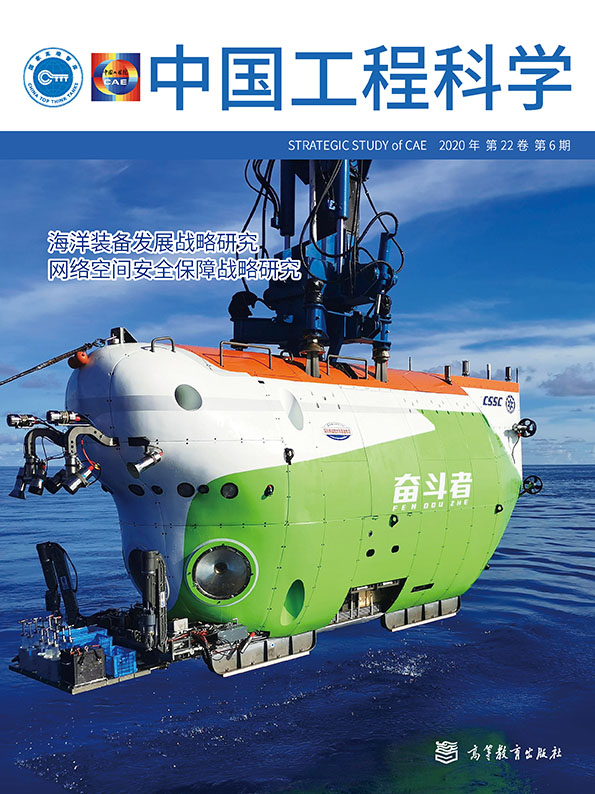
In recent years, China has made great progress in the research and application of HOVs, ROVs, AUVs, underwater gliders, and other vehicles, and some of these technologies have reached the world’s leading position. For example, the HOV Jiaolong completed sea trials at dive depths of 1000, 3000, 5000, and 7000 m. In 2012, it set a manned deep dive record of 7062 m in the Mariana Trench experimental sea area, which shows that China’s HOVs have the ability to operate in more than 99.8% of the world’s deep-sea areas.
Hailong II is a 3500 m-level ROV independently developed by China. It is equipped with a dynamic positioning system, virtual control system, camera monitoring system, image sonar system, and robotic arm that can extract heavy objects with a mass of 250 kg and an underwater speed of approximately 5.56 km/h. Hailong III is a 6000 m-level ROV independently researched and developed by China. It is capable of autonomous underwater cruises and heavy equipment operations. It can conduct marine surveys and scientific research operations under conditions of high temperature, high pressure, and complex terrain.
In the Qianlong series of AUVs, the Qianlong I has a designed diving depth of 6000 m and can detect seabed micro-landforms, seabed hydrological parameters, and the abundance of seabed polymetallic nodules. Qianlong II and Qianlong III have a diving depth of 4500 m. They use fish-shaped bionic structures to improve their underwater motion performance. They are equipped with high-end systems, such as those for submarine hydrothermal, submarine micro-topography, and submarine geomagnetic detection, which provide capability support for deep-sea submarine mineral resource exploration.
The development of underwater gliders has progressed rapidly and offers the conditions for large-scale applications. In terms of operational performance, the Haiyan series of underwater gliders have achieved trouble-free continuous operation for 141 d and continuous navigation of 3619.6 km. In terms of operating depth, the Haiyan 10 000-meter underwater glider dived to a world record of 10 619 m in the Mariana Trench, and the Haiyi underwater glider achieved continuous observation at a depth of 7000 m. With regard to collaboration and networking applications, the synchronized control of 12 underwater gliders has been achieved.
《4.4 Submarine observation network》
4.4 Submarine observation network
Since 2012, the Institute of Acoustics of the Chinese Academy of Sciences has taken the lead in building a submarine observation network test system in the East China Sea and South China Sea, with several sea-related research domestic institutions. The South China Sea Submarine Observation Network test system uses Hainan as the shore-based base station and utilizes a submarine photoelectric composite cable with a length of 150 km to connect multiple sets of marine physics, marine chemistry, and submarine dynamic observation platforms at a water depth of 1800 m to build seafloor seismic, seawater, marine biology, and other multidisciplinary multi-parameter long-term observation capabilities. China has deployed three sets of large buoys and 20 sets of deep-sea submersible buoys in the Western Pacific, South China Sea, and Indian Ocean, with a total of over 1000 pieces of marine scientific observation equipment, initially building a two-ocean and one-sea ocean observation network. It has simultaneously observed the upper equatorial current system in the western Pacific Ocean (vertical resolution of 8 m), the western boundary current, and the mid-deep circulation (vertical resolution of 500 m). The observation time resolution of all elements has reached 1 h, attaining an international leading level.
《5 Future development trends of marine scientific equipment》
5 Future development trends of marine scientific equipment
《5.1 Intelligent and unmanned marine scientific equipment》
5.1 Intelligent and unmanned marine scientific equipment
With the gradual development of ocean research toward the deep sea, human intervention in the activities of marine exploration/monitoring equipment will become increasingly difficult, and deep-sea exploration/observation will gradually develop into unattended automation and intelligence. For example, a new intelligent submersible can be submerged in a set sea for a long time. When an abnormal situation occurs in the monitoring range, the detection sensor automatically activates the device to track the target intelligently. The new smart buoys and submersible beacons can automatically select the appropriate information transmission and power supply methods according to the actual situation, and each subsystem independently selects the appropriate working mode according to the sea conditions. An underwater vehicle can be equipped with artificial intelligence (AI) and deep learning technology to automatically identify seabed obstacles and control the thrusters to avoid them.
《5.2 Genealogy of marine science equipment and three-dimensional observation system》
5.2 Genealogy of marine science equipment and three-dimensional observation system
With the increase in water depth applications, the type of observation parameters change, and marine scientific equipment with a single function will not be able to meet the comprehensive needs of future detection and observation. Multi-parameter and multi-functional pedigrees have become the development direction of related equipment. In the process of long-term exploration/observation operations, there is a tendency to adopt multiple types of marine scientific equipment to work together jointly, that is, multiple types of marine scientific equipment form a three-dimensional observation system through functional division and complementarity. For example, ocean observation systems in the United States and Japan generally consist of space-based equipment (i.e., satellites, aircraft, and drones), land-based equipment (i.e., hydrological observation stations and data management centers), sea-based equipment (i.e., scientific research ships, unmanned boats, and surface buoys), and seabed-based equipment (i.e., underwater submersibles, underwater vehicles, and underwater sensors), which conduct collaborative operations to achieve tasks that cannot be accomplished by a single device.
《5.3 Integration and globalization of marine scientific equipment》
5.3 Integration and globalization of marine scientific equipment
The ocean is a closely connected system, and changes in one area will cause a chain reaction in other areas. However, the volume of the ocean is too large for only a few countries to establish a detection/observation system covering the entire ocean. The cooperation of various countries to establish a global ocean detection/observation system will be one of the future development trends in ocean science, technology, and equipment. In the process of developing marine scientific equipment, China should pay attention to the global trend of marine exploration/observation technology innovation, participate in the formulation of international exploration/observation plans and international standards, carry out international cooperation and exchanges, and promote innovative development in the field more efficiently.
《6 Problems faced by China’s marine science equipment》
6 Problems faced by China’s marine science equipment
《6.1 General technology research on marine science equipment is lagging behind》
6.1 General technology research on marine science equipment is lagging behind
The progress in the research on marine science equipment focuses on integration. However, there are few original achievements and few breakthroughs and innovations with respect to the general technology. In the direction of high-performance materials, underwater energy supply, intelligent control, power drive, information transmission cables, and other technologies, and regarding equipment stability and reliability, operational flexibility, accuracy, convenience, and other application characteristics, there are still gaps compared to marine power. This results in problems to produce sufficiently advanced domestic equipment, difficulties for mass production, and low yield rates.
《6.2 Domestic equipment has high energy consumption and poor reliability, and core sensors rely on imports》
6.2 Domestic equipment has high energy consumption and poor reliability, and core sensors rely on imports
Owing to weak basic scientific research, the development of core sensor technology for marine science equipment is slow. This involves technologies for hydrological, ecological, current, sea gas flux, and hydroacoustic monitoring, and for other domestic sensors, where it is difficult to meet the performance required for actual applications. They are characterized by large size, high power consumption, poor reliability and stability, and are far from the application requirements of miniaturization, intelligence, and low power consumption. At present, the proportion of imports of high-end marine scientific equipment reaches 80%, and almost all of the commonly used heavy, acoustic, electrical, magnetic, shock, and other categories of sensors are imported, which restricts a comprehensive breakthrough in the field of marine science.
《6.3 The technical maturity of key equipment and commercial application level is not high》
6.3 The technical maturity of key equipment and commercial application level is not high
Most of the key marine scientific vehicles, including HOVs, ROVs, AUVs, and underwater gliders, except for a few that have been commercialized and produced on a small scale, are still in the stage of engineering prototypes, and most are supported by national policies and scientific research projects, while commercialization momentum is clearly missing. In contrast, the technological research and development of major marine scientific equipment of other marine powers is driven by the market and enterprises, and they have formed an efficient and sustainable business development model in the fields of marine scientific research, seabed mineral development, and offshore oil and gas development.
《6.4 The ocean stereoscopic observation network is not perfect and the degree of data sharing is low》
6.4 The ocean stereoscopic observation network is not perfect and the degree of data sharing is low
At present, the construction of China’s seabed observation network is in the initial stage, and only the two-ocean and one-sea ocean observation network has been developed. There are few observation points and they cannot fully cover the territorial sea space. There is still a long way to go to build an all-sea depth, integrated, real-time, high-resolution ocean three-dimensional observation network. In addition, there is a lack of rapid deployment observation capability, with HOVs, ROVs, AUVs, and underwater gliders as the core. Moreover, the absence of an integration and sharing management mechanism of observation data make the observation data stored scattered and held by different institutions, resulting in a serious waste of information resources [13].
《6.5 High-tech integration application lags behind》
6.5 High-tech integration application lags behind
The integration and application of marine scientific equipment and high-tech, such as AI, big data, and the Internet of Things, is relatively low in China. If we cannot explore and establish a transparent ocean observation technology system with its core equipment based on AI and big data as soon as possible, China will again face the situation of being left behind by the world’s ocean powers in terms of ocean technology. The lag of the technology system will lead to further amplification of the difficulty in core key technology breakthroughs.
《7 Suggestions》
7 Suggestions
《7.1 Strengthening of the basic theoretical research on marine science and design and development of key high-end marine science equipment》
7.1 Strengthening of the basic theoretical research on marine science and design and development of key high-end marine science equipment
Research should be strengthened on areas such as new deep-sea/polar special materials, underwater/under ice real-time communication, sensor system observation, autonomous energy supply, underwater/under ice high-precision navigation and positioning, underwater/under ice autonomous detection and identification, underwater/under ice automatic docking, splicing, deployment and recovery, ocean AI, and other key basic technologies. Thus, a solid foundation for the development of new deep-sea and polar scientific observation instruments, equipment, and systems will be created.
Research should be carried out on the characteristics of the polar physical sound field. There is a need to develop an acoustic hydrophone and transducer technology suitable for extreme environments in polar regions and deep seas. Research should be strengthened on the acoustic reflection and scattering characteristics of the water– gas and ice–gas interfaces, acoustic field propagation, and hydroacoustic communication technologies under the conditions of coexistence of the hemichannel and the full acoustic channel. It is necessary to fill the technical gaps, ensuring the development of deep and distant marine resources and implementation of the Arctic planning.
《7.2 Research and development of multi-functional intelligent marine scientific equipment and acceleration of the conversion process from technological achievements to shelf products》
7.2 Research and development of multi-functional intelligent marine scientific equipment and acceleration of the conversion process from technological achievements to shelf products
Obviously, the passive situation of tracking the mature foreign research and development on marine sensors should be reversed by exploring new concepts, principles, and methods of ocean observation, focusing on the research and development of miniaturized, intelligent, high-precision power environments, biogeochemical elements, and biogenetic, acoustic field, electromagnetic, gravity, and other new deep-sea multidisciplinary sensors. The development of new principles for deep-sea, chip-level, quantum-type ocean sensors, expanding the research frontier, should be supported to break the technological monopoly of ocean powers in traditional marine sensors.
The research and development of a new generation of multi-parameter intelligent AUVs, ROVs, underwater gliders, and other mobile observation equipment should be encouraged, focusing on the construction of an all-sea deep observation capacity, breaking through the constraints of pressure resistance, power consumption, navigation, platform stability, and sensor carrying capacity. There is a need to develop a genealogy of real-time floating/submersible markers, new concepts of fixed-based observation equipment, adaptive mobile-based and fixed-based conformal equipment for special power and ecological environments, and other multidisciplinary sensors. The aim is to enhance the real-time observation capacity of interdisciplinary multi-platform cooperative networks in the deep sea in a comprehensive way.
《7.3 Improvement of the marine science equipment sharing mechanism and comprehensive service platforms that play the role of marine science equipment in a wider scope》
7.3 Improvement of the marine science equipment sharing mechanism and comprehensive service platforms that play the role of marine science equipment in a wider scope
It is recommended to promote the synergy of superior resources in the marine field; unite the management departments, research institutes, and universities in the field; build a unified and efficient specialized management system; build a national-level large-scale marine scientific equipment sharing platform; establish unified use standards; clarify the scope of sharing, sharing standards, and sharing procedures; make overall arrangements for sharing units, allowing other users and individuals to use equipment applications; and publicly release sharing plans.
It is recommended to adopt the principle of paid use of marine scientific equipment. The initial implementation can be initiated in the form of state subsidies, and the funds for paid services can be unified in a later period. It is advised to realize the self-circulation of maintenance management and service charges and formulate management methods for sharing instruments and equipment to avoid the repeated procurement of equipment, repeated capacity building, idle facilities, and waste.
It is recommended that the relevant national authorities reasonably simplify the application procedures of non-profit organizations and provide appropriate preferential tax policies, encouraging enterprises and institutions to provide resource support for national basic scientific research, large-scale equipment operation, and maintenance activities.
《7.4 Strengthening of international cooperation and participation in the construction of standards, specifications, and calibration capabilities for international deep-sea observation instruments, equipment, and systems》
7.4 Strengthening of international cooperation and participation in the construction of standards, specifications, and calibration capabilities for international deep-sea observation instruments, equipment, and systems
It is advised to organize the domestic marine scientific research forces to participate actively in international cooperation plans and related coordination plans and promote international cooperation and exchanges. In this way, new types of deep-sea and polar ocean observation instruments, equipment, and systems should be developed. The focus should be on innovative research and development and typical applications; participation in the construction of an international standards system covering deep-sea and polar observation standards; and formulation of international standards and specifications for ocean observation equipment. China’s international influence on deep-sea/polar observation instruments, equipment, and systems should be improved. In response to the harsh requirements of deep-sea/polar observations regarding sensor accuracy, a diversified and systematic deep-sea sensor calibration system should be constructed to enhance the country’s international voice in deep-sea observation data.


 京公网安备 11010502051620号


